Ship navigation and Systems Engineering can be an excellent fit
Backbone of the world economy
Maritime transport has supported world commerce for centuries. Now it is the backbone of world trade, making up around 80% of the volume of international trade in goods. Key to this is ship navigation, the process of ensuring a ship gets to where it is going without becoming another statistic in a featureless ocean. In the last decade, global shipping, and the movement of goods by sea have seen substantial changes in the number of ships and their size. The average capacity of container ships has grown from less than 3,000 to circa 4,500 Twenty-foot Equivalent Units (TEUs) in the last decade. More than fifty mega-ships in the world have a capacity of 21,000 TEUs.
Navigation is a journey, not a destination
The navigation process comprises planning, execution, and monitoring. A voyage plan includes, among other information, the time of departure and an estimated time of arrival.
_______________________________________________________________________________________________________________
In 1999, the International Maritime Organization (IMO), a United Nations (UN) specialised agency, adopted resolution A.893 (21) - Guidelines for Voyage Planning, concerning all necessary information for voyage planning. ______________________________________________________________________________________________________________
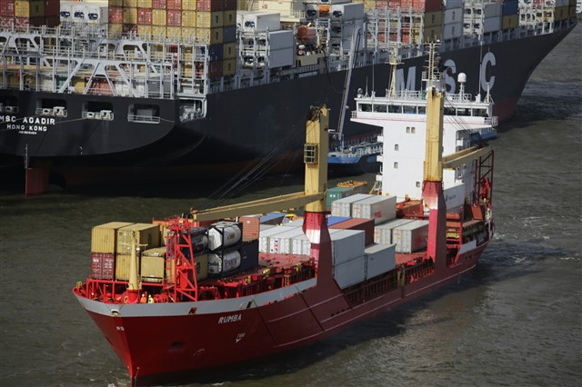
Waltershof, Hamburg, Germany. Source: Bernd Dittrich on Unsplash
During execution, the voyage plan should be updated to account for information received on board from shore- based centres (e.g., Vessel Traffic Services (VTS) centres). For example, if a Notice to Mariners reports storm conditions along a shipping route, then a ship navigating that route might consider deviating from the originally planned route to avoid the harsh weather.
________________________________________________________________________________________________________________
In 1985, the IMO adopted the resolution A.578 (14) - Guidelines for Vessel Traffic Services, recommending the establishment of VTS in the approaches and access channels of port and in areas of high traffic density.
________________________________________________________________________________________________________________
Operating a ship for maritime transport requires a large (and growing) volume of administrative work. It also needs thorough communications from ship-to-ship, ship-to-shore, and shore-to-ship. At the beginning of this century, it was clear administration, and communications could both be aided by developments in technology. There were concerns that new navigation technologies would be developed in an uncoordinated way, confusing rather than helping mariners.
Everything comes with an ‘E’
Consequently, starting from 2006, the IMO Maritime Safety Committee (MSC) introduced the ‘e-navigation’ concept. In 2019 it adopted the strategic implementation plan (SIP) based on prioritised e-navigation solutions, allowing the industry to begin work on products and services in a harmonised and coordinated way.
________________________________________________________________________________________________________________
E-navigation is defined as, “the harmonised collection, integration, exchange, presentation and analysis of marine information on-board and ashore by electronic means to enhance berth-to-berth navigation and related services for safety and security at sea and protection of the marine environment.”
________________________________________________________________________________________________________________
E-navigation is driven by user needs and a Systems Engineering (SE) approach has been central to the development of its architecture. SE provides the tools to manage connections with real world systems and address the constantly evolving challenges of technology development and regulation change. It helps avoid omission and invalid assumptions and sets the basis for a detailed implementation of the overarching e-navigation architecture, something demanded by national states’ competent authorities.
Inter-Railing
Maritime transport is becoming ever more integrated in interconnected logistic chains and the global economy, with smart ports connecting land corridors with maritime routes. For instance, in 2010, the European Commission launched the Motorways of the Sea concept, aiming to shift the balance between modes of transport to an environment-friendly mix. They also targeted the removal of bottlenecks by revitalising railways, promoting sea routes and inland waterways, and linking up different modes of transport as part of an integrated transport chain. The Chinese Government also launched its Belt and Road Initiative in 2013, coinciding with a change in development strategy that made infrastructure investments a priority in China and abroad.
The domains
Systems Engineering is not universally mandatory in developing the detailed representation of e-navigation architecture by different countries, though may be demanded for local implementation. The application of SE is often limited to technology-oriented developments, although it would be beneficial to focus on a more human-oriented development of these systems.
Recent developments in the maritime sector, such as smart ports and drone ships, are characterised by interactions between at least four domains:
- Physical Domain, where effects take place and where other supporting infrastructures & information systems exist
- Information Domain, where information is created, manipulated, and shared
- Cognitive Domain, where perceptions, awareness, beliefs, and values reside and where, because of sense making, decisions are made
- Social Domain, as a set of interactions between and among living entities.
The ability of SE to take a complex set of circumstances and practices, examine it in the round and create a harmonious, frictionless system could be the best method to build a smooth, safe passage for international commerce and movement on the high seas.
Share your thoughts!
How does Systems Engineering affect ship safety?
Given how unpredictable the sea can be, how can Systems Engineering make shipping even safer?
How could Systems Engineering make a human crew redundant?
#thewholesystem
-

Peter Brooks
-
Cancel
-
Vote Up
0
Vote Down
-
-
Sign in to reply
-
More
-
Cancel
Comment-

Peter Brooks
-
Cancel
-
Vote Up
0
Vote Down
-
-
Sign in to reply
-
More
-
Cancel
Children